
Situational Awareness in Your Operating Area
Know what's happening in the airspace above you — while you fly. We supply the receivers with instructions, you set them up in your area — they detect the actual air traffic and make it visible to you and your remote pilots.
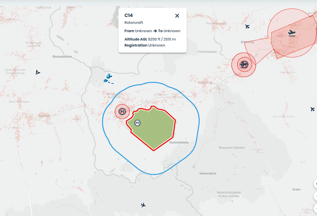
The Airspace Above Your Operating Area Isn't Map Knowledge
Maps show zones, but not who is actually flying. An air picture from your own receivers closes that gap.
Gliders and paragliders aren't on any map
No airspace chart shows who is actually moving through your operational volume. Gliders, hang gliders, rescue helicopters and light aviation only show up once you measure on site.The same volumes, every day
Drone-in-a-box systems fly the same volumes daily and for years. A live air picture turns a one-off assumption into continuous observation.Your remote pilots make better decisions
If you know manned aviation is approaching, you can react earlier: postpone the flight, reduce altitude, land. That is the core of improved situational awareness.
From Site to Air Picture
Four steps. You take care of mounting; after installation, the air picture runs continuously.
Site selection
You choose the mounting point; we advise you so that it covers your operational volume and the adjacent areas.Installation
You mount the receiver and combined antenna following our instructions; we check connectivity and reception quality with you.Air picture
Detected aircraft appear continuously — with category, altitude and detection source.Operating procedures
We define how your remote pilots respond to the air picture — and write it into your operations manual.
One Receiver for All Relevant Protocols
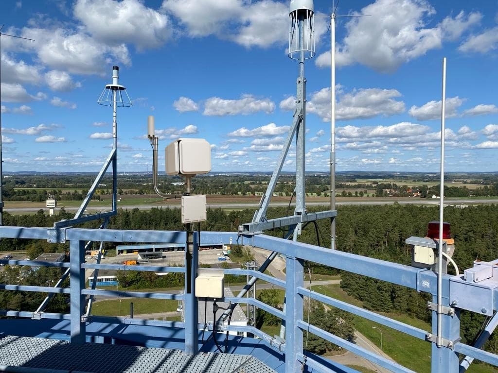
One device detects manned aviation and drones across all common protocols – with a single antenna and under 5 W power consumption.
- Air protocols
- ADS-B / Mode A/C/S, UAT978 (alternative), FLARM, OGN, PilotAware, FANET, ADS-L
- Drone detection
- Drone Remote ID via WiFi and Bluetooth — no additional hardware
- Timestamps
- GNSS-synchronised with nanosecond resolution
- Connectivity
- Ethernet, WiFi, Bluetooth or optional 4G LTE modem
- Installation
- One combined antenna for 868 and 1090 MHz, under 5 W power consumption, no moving parts
- Location
- Desktop housing or rugged outdoor version for masts and open terrain
What the Air Picture Gives Your Remote Pilots
During operations, the reception data becomes a basis for decisions – for each individual flight and for your procedures.
Who is flying, at what altitude
Detected aircraft with category, altitude band and detection source — not just a dot on the map.React earlier instead of explaining later
Approaching traffic becomes visible before it matters. Your remote pilots have time to decide.Procedures that match the air picture
Together with you, we define how to respond to which event and document it traceably in your operations manual.Recording for review
All detections are stored. If needed, they become the air traffic report for your application.
Situational Awareness or Air Traffic Report?
The same hardware, two different purposes. Usually, it makes sense to combine them.
Situational Awareness
Runs alongside operations. Its purpose is the air picture for your remote pilots and the procedures that depend on it. Not a document, but an ongoing function.Book an appointmentAir Traffic Report
Looks back. Its purpose is evidence for the authority: which traffic occurs in the operational volume and via which protocol it is detectable. This makes the report a possible basis for your air risk mitigation.Learn more
The Right Configuration for Your Area
Which hardware configuration you need depends on your operating area: how large it is, how the terrain blocks the line of sight and which connectivity is available on site.
We advise you on the selection and prepare a quote for the configuration that suits your operation.
Frequently Asked Questions About Situational Awareness
On hardware, mounting and how it works together with the air traffic report, we answer the most common questions here.
Not necessarily. For the application, the air traffic report counts as an air risk mitigation. A live air picture is an operational function — it helps your remote pilots day to day and supports procedures you describe in your operations manual.
Yes. The same receiver delivers both: the live air picture and the data basis for the analysis. If you are having measurements taken anyway, you get the air picture without a second installation.
No. What is detectable is whatever transmits via one of the supported protocols. Non-cooperative aircraft without a transponder remain invisible — your procedures need to account for that.
You choose the mounting point. We advise you, based on your operational volume and the adjacent areas. You mount it on site — hardware and instructions come from us. You need a clear view for the combined antenna, power and connectivity. The outdoor version is built for masts and open terrain.
Already have an operating area in mind? Book an initial consultation or write to office@skyzr.com.
More Than the Air Picture
The air picture helps during operations. For the approval itself, these two services complement your situational awareness.
SORA Consulting
Risk analysis, concept of operations and application for the Specific category — we guide you through the entire SORA process up to the operations manual.Learn more →Air Traffic Report for BVLOS
For BVLOS from a drone-in-a-box: measurement in your operating area, an air traffic report, and its integration into the SORA analysis as an air risk mitigation.Learn more →