
Making BVLOS Possible – With Air Risk Mitigation Based on Reliable Measurement Data
Without reliable airspace data, the application stalls. We deliver the measurement and analysis that make your BVLOS operation approvable.
Air Risk Mitigation Decides Whether Your BVLOS Operation Is Approvable and Economical
The lower the air risk class (ARC), the less you need to secure during operations – and the lower your SAIL.
Without visual contact, air risk is what counts
If you fly without visual contact and without an observer, an encounter with manned aviation is the biggest risk. How high it is in your area is defined by the air risk class (ARC).A high ARC means high effort
The higher the ARC, the more you need to secure tactically: airspace observation, detect and avoid, additional procedures. That costs equipment and staff and raises your SAIL.Strategic mitigation lowers both
If you prove with measurement data that there is little traffic in your operational volume, the ARC drops before the flight. That saves tactical effort and keeps your operation at a lower SAIL.
Why It Gets Difficult Without a Data Basis
Without measurement data from your operational volume, the assessment relies on assumptions and statistics – and both are interpreted conservatively.
Assumptions are assessed conservatively
The authority assesses assumptions without measurement data conservatively. When in doubt, the higher ARC stands.General statistics instead of real traffic
In uncontrolled airspace, the authority only has general aviation statistics, too. They often don't reflect the actual traffic in your operational volume – gliders, paragliders and rescue helicopters included.ARC-b requires evidence
According to EASA guidance, an airspace can be classified as ARC-b if at least 50% of manned traffic is detectable. You need to prove this share for your operational volume, and that only works with measurement data.Rework costs months
Follow-up questions, conditions and rework delay the start of operations by months — and measurement data needs lead time anyway.
Four Building Blocks for Successful Air Risk Mitigation
Hardware alone doesn't help. The value comes from data collection, analysis and integration into the application.
01 — openAir multitrack
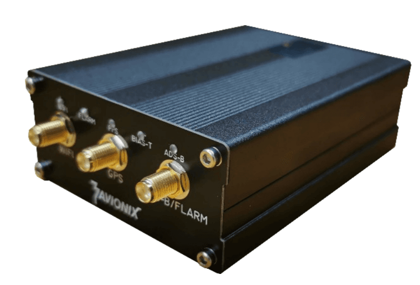
All-in-one receiver for ADS-B, Mode A/C/S, FLARM, OGN, PilotAware, FANET, ADS-L and UAT978 with an integrated GNSS module. Optional, but only measurement data on site makes the report truly reliable.02 — Data collection
Up to three months of continuous recording in your operating area. Every message timestamped in GNSS sync.03 — Air traffic report
Analysis and report generation in wingman: detected aircraft by category and source, plus minimum and maximum altitude within the detection volume.04 — Expert support
Our experts bring the report into your application for the Specific category as an air risk mitigation.
One Receiver for All Relevant Protocols
The openAir multitrack detects manned aviation and drones across all common protocols – the data basis for the report.
- Air protocols
- ADS-B / Mode A/C/S, UAT978 (alternative), FLARM, OGN, PilotAware, FANET, ADS-L
- Drone detection
- Drone Remote ID via WiFi and Bluetooth — no additional hardware
- Timestamps
- GNSS-synchronised with nanosecond resolution — the basis for duplicate filtering and multilateration
- Connectivity
- Ethernet, WiFi, Bluetooth or optional 4G LTE modem
- Installation
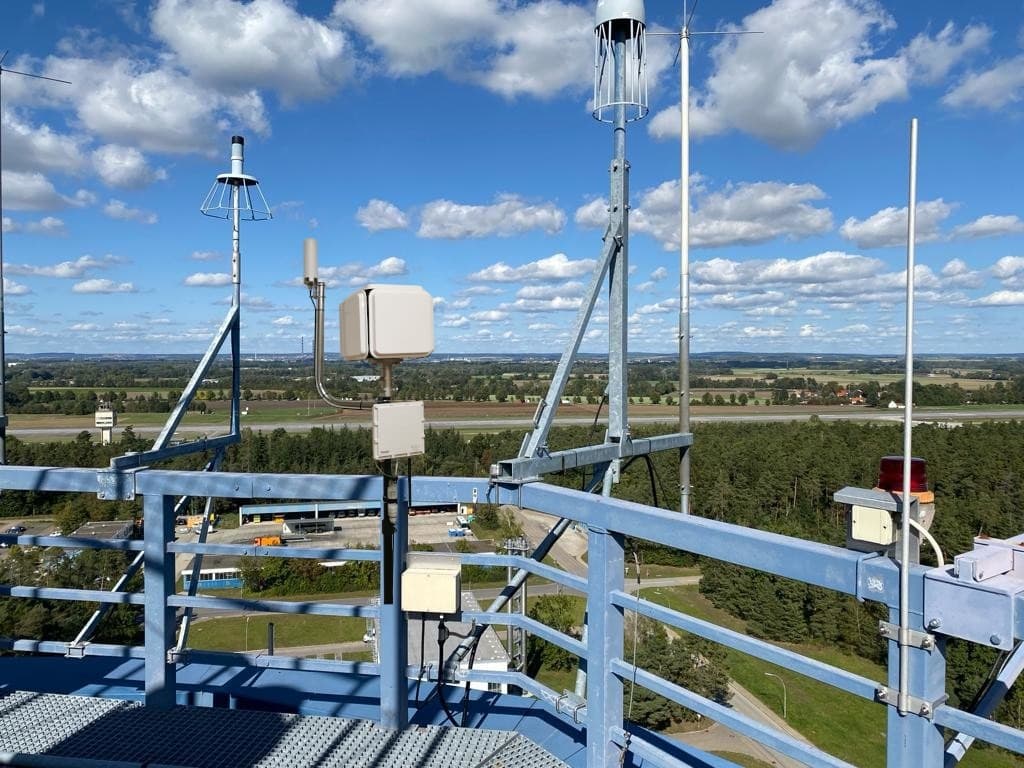
- One combined antenna for 868 and 1090 MHz, under 5 W power consumption, no moving parts
- Location
- Desktop housing or rugged outdoor version for masts and open terrain
From Installation to Application
Data collection needs lead time. If you want to fly in summer, you need to measure in spring.
Site selection
Week 1 — plan the SORA buffer zones in wingman and choose the mounting point, with our advice.Installation
Week 2 — you mount the receiver and combined antenna following our instructions; connectivity and reception are checked.Data collection
Up to 3 months — continuous recording of all detected airspace users.Analysis
2 weeks — skyzr analyses the data in wingman and produces the air traffic report.Integration
Ongoing — our experts support your application in the Specific category.
The radius is the adjacent area calculated automatically by the wingman software — plus the position in decimal form and the query period.
What the Air Traffic Report Contains
Count per category, detection source and altitude band — the three dimensions the authority asks about.
Detected aircraft by source and category
Excerpt from a reportCount and lowest and highest recorded altitude per aircraft category, grouped by detection source.
| Category by source | Count | Min. altitude (ft) | Max. altitude (ft) |
|---|---|---|---|
| ADS-B | 91 | 3400 | 12025 |
| GliderSailplane | 7 | 3950 | 11050 |
| Large | 1 | 5350 | 5550 |
| Light | 56 | 3725 | 12025 |
| ParachutistSkydiver | 2 | 4450 | 7625 |
| Rotorcraft | 17 | 3400 | 8250 |
| Small | 2 | 4700 | 8100 |
| UltralightHangGliderParaglider | 6 | 3725 | 8175 |
| FANET | 90 | 0 | 11837 |
| HangGlider | 4 | 3667 | 9304 |
| ParaGlider | 86 | 0 | 11837 |
| FLARM | 36 | 5846 | 15380 |
| Glider | 31 | 5846 | 15380 |
| Helicopter | 1 | 5889 | 5994 |
| ParaGlider | 1 | 6610 | 8835 |
| PoweredAircraft | 3 | 6692 | 7919 |
| Total | 262 | 0 | 15380 |
How the Report Works in Your Application
The measurement data becomes an air risk mitigation that feeds into the SORA analysis of your application.
Prove the traffic
Recorded data shows which aircraft actually operate in the adjacent area calculated by wingman.Prove detectability
The report shows via which protocol they are detectable — during the flight as well (TMPR).Increase situational awareness
Together with other mitigations, this results in significantly improved situational awareness.Bring it in as a mitigation
Integration as an air risk mitigation into the SORA analysis of your application.
Typical accompanying mitigations
- NOTAM issued to all airspace users for flights above 120 m AGL
- UTM entry of the flight
- FLARM transmitter on the drone
- DJI AirSense additionally detects ADS-B-cooperative aircraft
Which mitigations make sense depends on the concept of operations. We agree on the combination together with you.
We Have Already Applied This Form of Mitigation Successfully Several Times
A selection of the drone operators whose application we supported with an air traffic report.

What the Package Includes
Everything you need as evidence for the authority. We tailor the quote to your operating area.
- openAir multitrack receiverPurchase of the hardware in the configuration that suits your operating area, including the combined antenna.
- Hardware configuration adviceWe advise you on selection and mounting point, based on the adjacent area calculated in wingman.
- Mounting instructionsYou mount it on site following our instructions; we check connectivity and reception quality with you.
- Data collection for up to three monthsContinuous recording of ADS-B, FLARM, FANET and other protocols in your operational volume. Interim analyses possible.
- Air traffic reportAnalysis by source, category and altitude band as evidence for your air risk mitigation.
- Application supportWe bring the report into your SORA and answer the authority's follow-up questions.
Frequently Asked Questions About the Air Traffic Report
On measurement duration, mounting and the scope of the report, we answer the most common questions here.
Up to three months continuously. The period needs to be meaningful for your operational volume — in alpine regions, for example, that means covering the gliding and paragliding season. Add around two weeks for analysis and the report.
You choose the mounting point. We advise you, based on the adjacent area calculated in wingman. You mount it on site — hardware and instructions come from us. You need a clear view for the combined antenna, power and connectivity — Ethernet, WiFi or the optional 4G LTE modem. The outdoor version is built for masts and open terrain.
No. A report applies to the measured detection volume and the recorded period. If you operate several areas, you need a recording for each — which is why buying the receiver is the more economical option.
Usually not. The package is designed for BVLOS operations, where an encounter with manned aviation is the dominant residual risk. Whether your project needs it, we clarify in the initial consultation.
No. We cannot guarantee that an application will succeed; the decision lies with the competent authority. We have already applied this form of mitigation successfully several times — we provide the data and the expert support.
Already have an operating area in mind? Book an initial consultation or write to office@skyzr.com.
More Than the Air Traffic Report
The report is one building block of your application. These two services complement it – for the approval and for ongoing operations.
SORA Consulting
Risk analysis, concept of operations and application for the Specific category — we guide you through the entire SORA process up to the operations manual.Learn more →Situational Awareness
Receivers in your operating area make the actual air traffic visible — hardware and instructions from us, as a live air picture for your remote pilots.Learn more →